


Pix4Dfields
Parrot
Drone mapping software for aerial crop analysis and precision agriculture.


Product description Brand name and product description
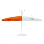
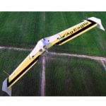
Pix4Dfields is a photogrammetry software designed for precision agriculture and crop analysis. It digitizes fields by converting drone images into orthomosaics, digital surface models, index maps, zones and prescription maps allowing maximization of operational efficiency.
Target region(s) Target region for distribution/implementation (listed by country if specified)
Distributors/implementing organizations Organization(s) distributing/deploying this product directly to communities/individuals?"
Market suggested retail price Price per unit or service price per usage/terms (USD). Subsidies noted.
Competitive landscape Similar products available on the market. May not be a comprehensive listing.
SDG targeted United Nations Sustainable Development Goals (SDGs) targeted with this product/application/service
Goal 2: Zero hunger
Target user(s) Target user/consumer base (country, income segment)
Precision farmers worldwide